ARTWORK:
This artwork is about using technolgies to re map and re draw the landscape. Using GPS devices that track position in space one can use this equipment to make real estates or virtual cities. These are places that don't exist but we dream of making. This art project is about enabling this to happen. Who owns the land? Well in virtual cities we can all make our own grand estates. By using GPS systems that are normally used for exact location it is possible to create metaphors for a new or rather different urban identity.
OUTPUT:
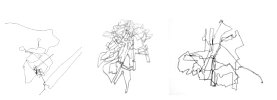
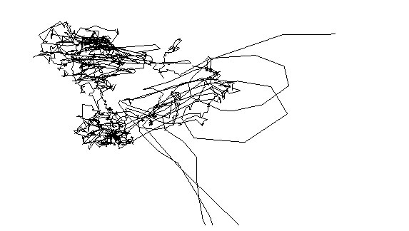
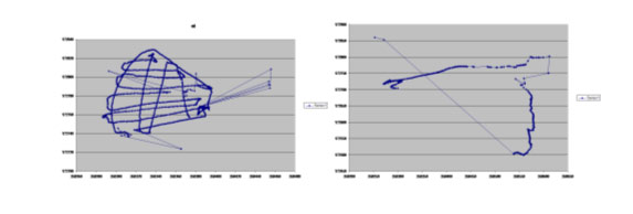
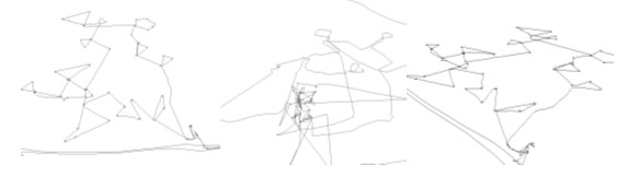
Using GPS to make virtual towns that will be auctioned on EBAY. A virtual real estate. A trading platform (patent pending) is in development that will allow the real time trading of virtual real estates as they are made on the open virtual market (Irma tm). To test the system, some GPS mappings of various environments using various GPS technology where used to test the accuracy of current gps technology in the UK.
VIRTUAL CITIES
- The creation of a virtual city in decayed parts of the city. The city space is made by active by participants who design their own 'dream' home onto the global satellite system.
- Making new towns in remote locations. A new town is mapped out onto the new forest.
- The city as data space. Participants are asked to make drawings of houses or urban plans, then shown various ways to use the GPS system to make collective drawings, made by selected walks in the location.
- The drawings as maps and plans become available on the internet. As idealized spaces the virtual real estate would be auctioned off to the highest bidder online via Ebay.
Possible outcomes would be a rush on virtual property prices. Benefits would be that you would own you own property without being held hostage by the banking sector who act as corporate landlords.
- Workshops and group walking projects in inner-city locations involved swaps, so people can build their own plots
- Auction estates on ebay to the highest bidder.